Out In The Woods – Stone Walls Tell Stories
- March 2nd 2024
- Out in the Woods

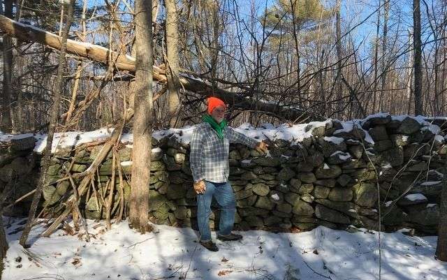
Like wall wardens of old, Steve Mallon inspects a wall forming the boundary between Springvale and Lebanon
Photo: Kevin McKeon
By Kevin McKeon, Director, Mousam Way Land Trust
Earth was born in a fiery blazing tempest 4.5 billion years ago, molten lava forming a bubbling, red-hot ocean. Heavy metals sank, forming a solid inner core of iron and a liquid outer core, surrounded by an enormous pliable rock mantle. Gasses boiled up forming a primal, noxious atmosphere holding almost all of Earth’s water. Rain hitting the hot surface turned back to steam, creating a thick, sun-blocking atmosphere. Lava’s glow and constant meteorite bombardment gave Earth a dull yellow glow. Then, it cooled – and it rained, torrentially for thousands of years. Raging rivers seeking low ground poured into huge lakes, eventually forming a global ocean. Massive eruptions of magma blasted through the basalt crust creating a huge continent. Under this, a 50-mile-thick upper mantle formed and cracked into tectonic plates, gliding with the attached continents over the pliable mantle. It was 400 million years ago—the Acadian Orogeny.
The continents then slammed into each other at what is now New England, their attached plates scraping colossal amounts of drab oceanic mud, blocks of crust, and underwater islands, adding it to the shoreline at the collisions. This mud combined with various elements, baking and folding under heat and pressure, forming beautiful, banded rock formations with colorful mineral specks and crystals of feldspar and garnet, and veins of precious metals. Super continent Pangea was thus formed and with it, the Appalachian Mountains, the birthplace of our stone wall’s rocks.
Earth’s heat expanded Pangea to a mile-high bulge and, like rising bread dough, cracked it into today’s continents. Rift zones and basins were created. One of these basins is the Atlantic Ocean. Back in New England, eroded sand, mud, and decayed vegetative matter from the interior forests drained towards the ocean for over 250 million years. This became our coastal plain. Then, a gentle broad uplift formed the New England Plateau.
Several glacial events, some 2 miles thick, scraped the lands for 50 million years, depositing a thick, muddy, stony paste called Lodgement Till on the New England Plateau. Melting glaciers, carrying lighter sand and silt, settled on the lodgement, evolving into a soil rich in nutrients and rocks.
Prior to the American Revolution, walls were made from plentiful wood. Forests were cut and burned to create farmland. Families used 35 cords for winter heating and even more for cleaning, butchering, and sap-boiling. But during the war, acre by acre trees were turned into charcoal for factories supporting the war. Women and children worked the farms, necessarily leaving heavy rocks in the fields. Post war, family and factory demand for wood made it too valuable to use for fixing rotting walls, so stone became the economical option, using cheap labor from post-war baby boomers, freed slaves, landless farmers, disabled veterans, and other unemployed folk. And the geological forces in the soil kept the rocks coming.
Thick mulch and winter snows prevented ancient forest soils from freezing. Deforestation and tilling opened the soil to deep freezing, and the glacial till soils of New England are especially prone to various water forces, including ancient rocks being frost heaved to the surface; New England really does “grow” rocks! Rock clearing was a constant chore, and the placement of rocks helps tell the story of a farm’s resources and wealth.
Large fields allow horses to turn less often, so rocks were carried as far as strength would allow. They were first piled in the middle of the fields, covering tillable land. As land values increased, rocks were placed at the farm’s boundaries, which were often along the contours. Thus, efficiencies dictated square fields of approximately 3 acres, with wealthier farms able to haul stones further with horses, creating the larger fields seen today, while the walls of smaller, less efficient farms with poorer soils were abandoned to Nature’s force, returning to the forests.
As you stroll by these old walls, be amazed by the fire that created the rock, and the ice that brought them to us.


